


A wide range of Geospatial products
We have an enviable library of geospatial data available and accessible immediately via our Mapshop including aerial photography and terrain data.
In addition, we offer tailored and bespoke solutions to support specific customer projects and have unique solutions like our National Tree Map™ and the innovative 3D mesh product, MetroVista™.


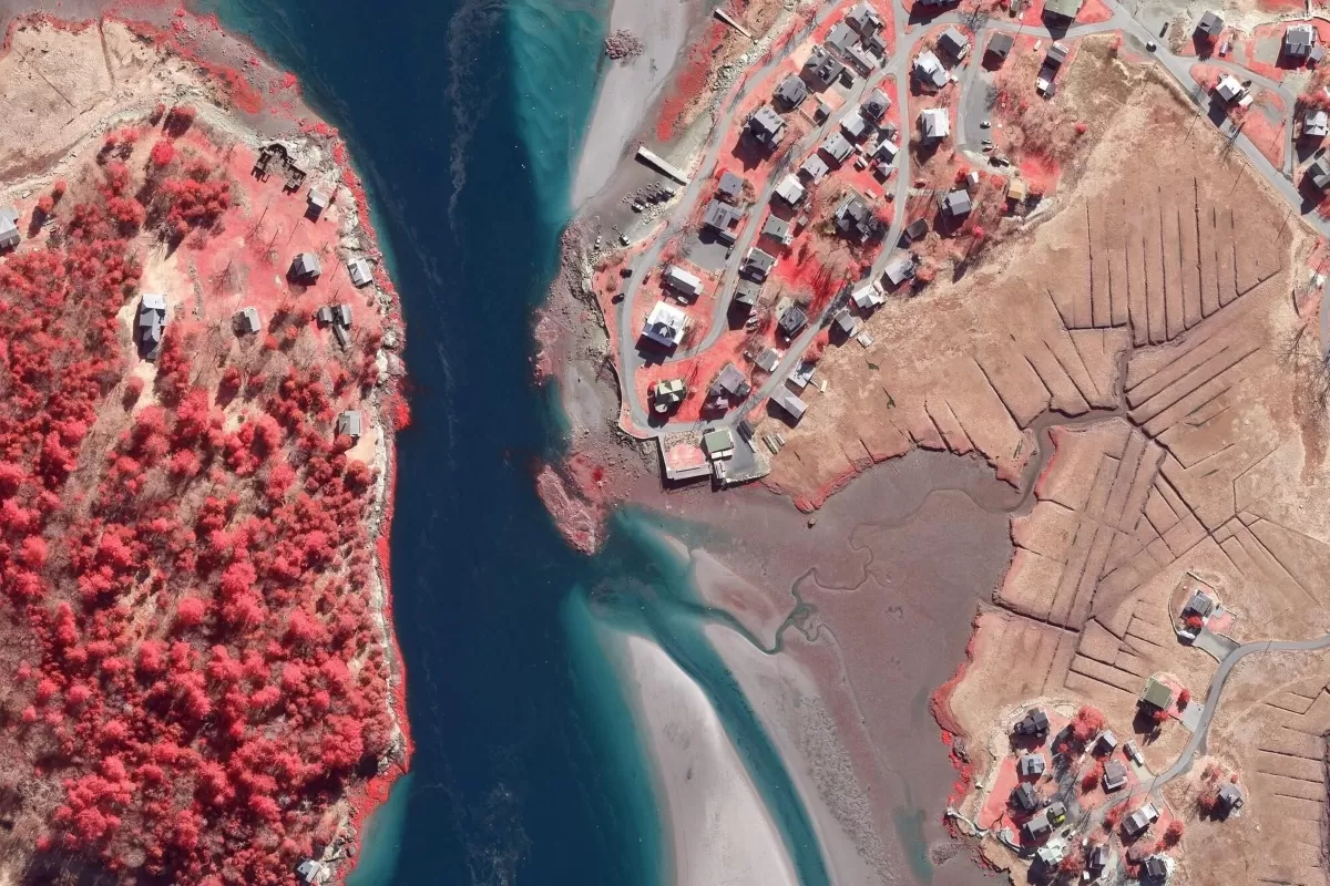
Aerial Photography
We have a full library of aerial imagery of the Republic of Ireland and Great Britain at high resolution including many areas mapped at 5cm and 12.5cm.

National Tree Map™
Our National Tree Map™ is a unique dataset that maps the height, location and tree canopy of trees 3 metres and taller in the Republic of Ireland, England, Wales and Scotland.
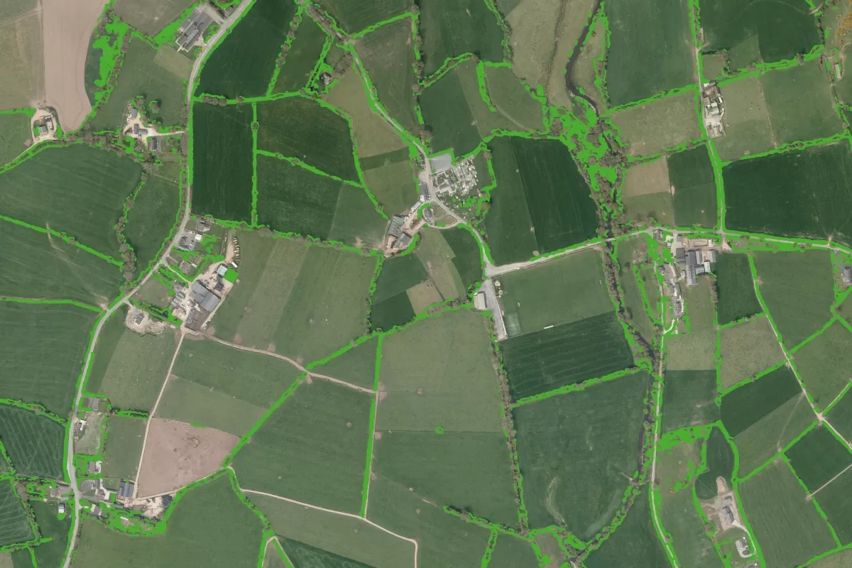
National Hedgerow Map™
Our National Hedgerow Map™ is a unique dataset that maps the location, extent and volume of hedgerows under 3 metres in the Republic of Ireland, England, Wales and Scotland.

Photogrammetric DSM
Our photogrammetrically derived digital surface models (DSM) are available as a grid of heightened points and contours at 25cm intervals.

Photogrammetric DTM
Our photogrammetrically derived digital terrain models (DTM) are available as a grid of heightened points and contours at 5m intervals.
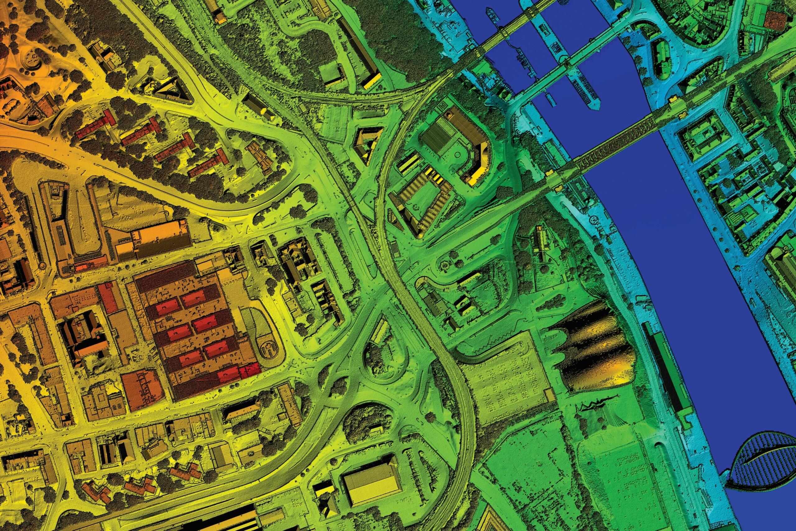
LiDAR Height Data
We capture detailed and accurate terrain information including the height of both the terrain and any above ground features, such as trees and buildings.

MetroVista™ Mesh Models
We have captured 20 cities across the UK and Ireland to create intricate 3D mesh models which are an ideal baseline for a number of applications, including the creation of digital twins.

Bespoke Solutions
Get in touch with our technical sales team at ireland@bluesky-world.com to discuss your requirements and we can provide you with a tailored quote.
GeoStream:
Data as a Service
Our GeoStream subscription service provides unlimited access to Bluesky data which is centrally hosted
We have listened to our customers and we believe our GeoStream subscription offers the flexibility and value they need. It really is an ‘all-you-can-consume’ service enabling the user to access our national aerial imagery data and then add the layers they need when they need them. These includes all our terrain datasets for Ireland and Great Britain, as well as our newly launched MetroVista™ 3D mesh model products, our unique National Tree Map™ and 5cm resolution city imagery.
Please talk to us to find out how you can start using Bluesky’s market leading data without limits