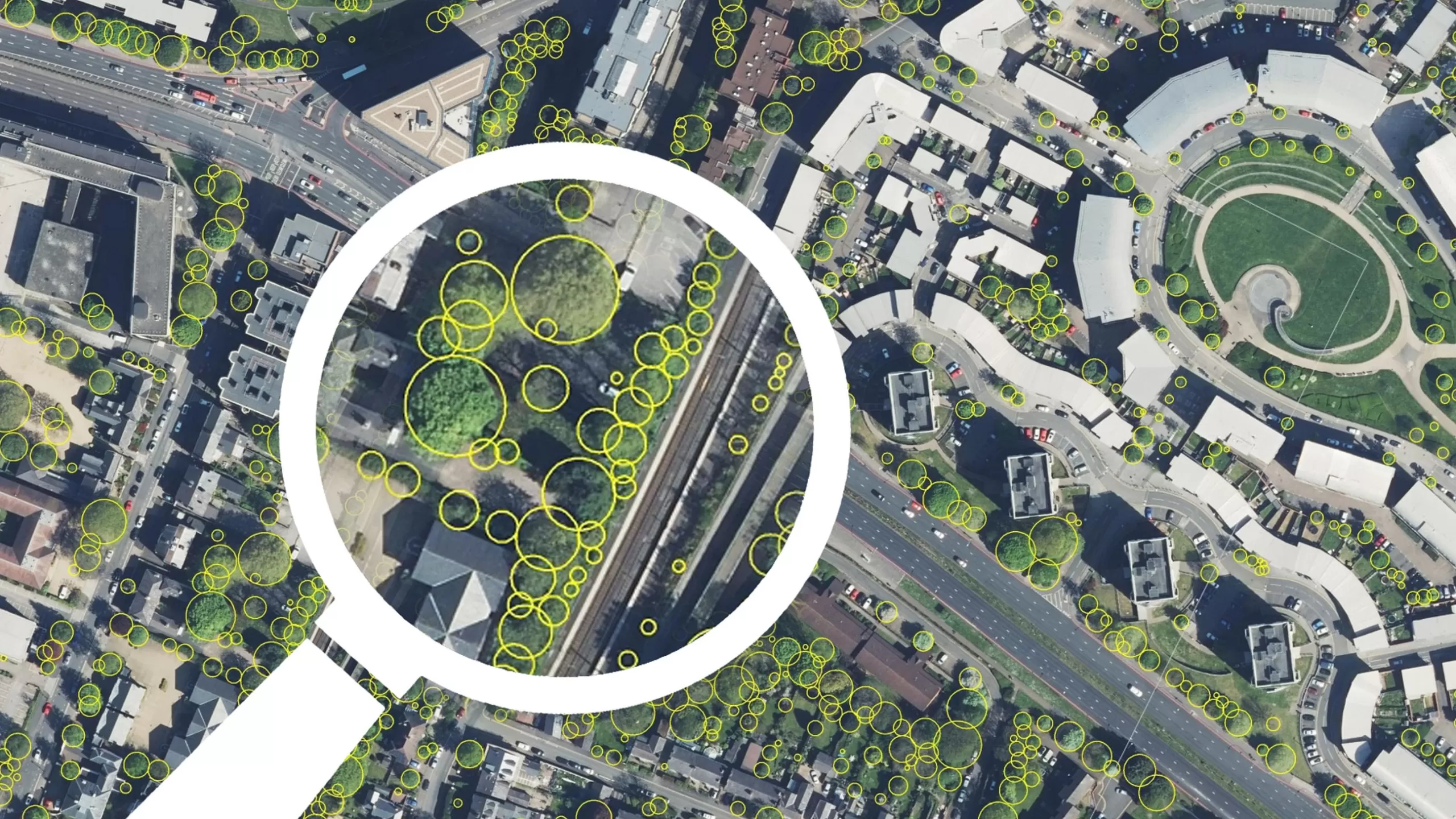


National Tree Map™
The Bluesky National Tree Map™ (NTM™) is the only tree dataset to include trees in the Republic of Ireland and Great Britain that are 3 metres and taller. It captures height, location and canopy/crown extent of trees, whether in urban or rural areas, in small clusters, woodlands and forests, or single trees.
The NTM™ has been created using proprietary algorithms and processing techniques that use our high resolution national aerial photography, terrain and surface data, and colour infrared imagery. The data is updated regularly as part of our cyclic aerial imagery capture and update programme.
Understanding and monitoring the environment is becoming increasingly critical as we strive to reduce our carbon output, assess carbon capture opportunities, and enhance our natural environment. Geospatial data holds the key to understanding our baselines and identifying where resources should be concentrated for tree planting. It’s critical that schemes achieve maximum impact, whether they are tackling the climate crisis, improving the permeability of the landscape, or increasing biodiversity.
With the introduction of Biodiversity Net Gain (BNG) legislation in early 2024, tools like the NTM™ will offer specialist support in understanding the landscape to ensure informed decisions can be made to achieve the mandatory BNG of 10 per cent.
The NTM™ is already being widely used as a support tool for environment and sustainability teams in local authorities, planning teams, renewable energy and environment sectors, architecture and design, insurance, utilities, as well as forestry, land and estate management.
It can also be combined with data from our new National Hedgerow Map™ for a comprehensive analysis of all vegetation.
Specification
-
Trees 3m and taller
- Measurements of location, height and canopy spread
-
Idealised crowns
-
Detailed crowns
-
Height points
-
Created from stereo aerial photography
-
Vector format – ESRI .shp as standard
Applications
-
Tree management (including TPOs)
-
Canopy coverage analysis
-
Insurance risk assessment
-
Utility asset management
-
Impact on utilities & overhead lines
-
Visualisation and modelling
-
Flood and pollution modelling
Benefits
-
Unique product – the only tree map in Ireland
-
Compatible with Bluesky’s National Hedgerow Map™
- Easy-to-use vector data
- Flexible licensing terms
- Continually updated
- Compatible with OS Ireland & other base mapping products

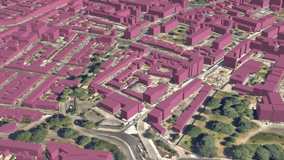
National Tree Map™ Features