


August 2023
-
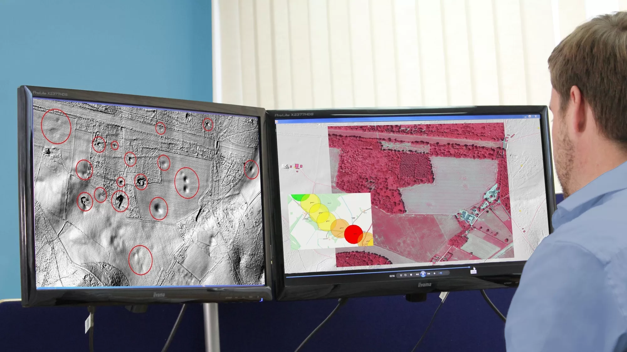
Bluesky Aerial Data Helps CGL Pinpoint Natural Hazards at Development Sites
A geotechnical and consultancy agency is using geospatial data to work smarter, saving significant time and money, both for themselves and their clients. Card Geotechnics Ltd (CGL) is applying aerial…
Read More
July 2023
-
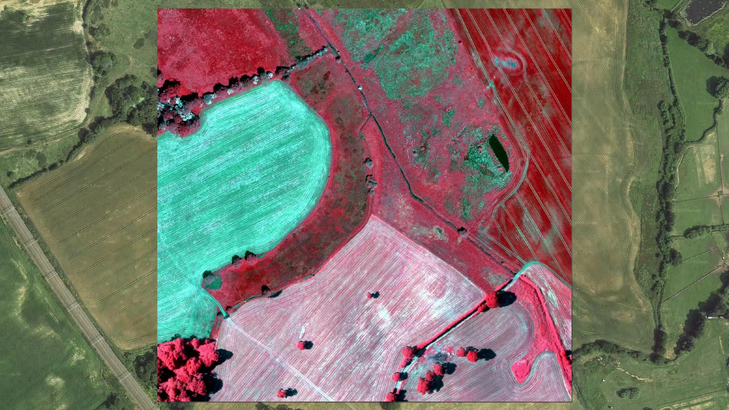
Bluesky’s Airborne Sensors Help Developers Protect Wildlife Habitats
Multi-spectral imagery from Bluesky International is helping developers contribute to government targets to protect and conserve wildlife habitats in the UK. Using the latest Artificial Intelligence (AI) technology, in combination…
Read More
June 2021
-
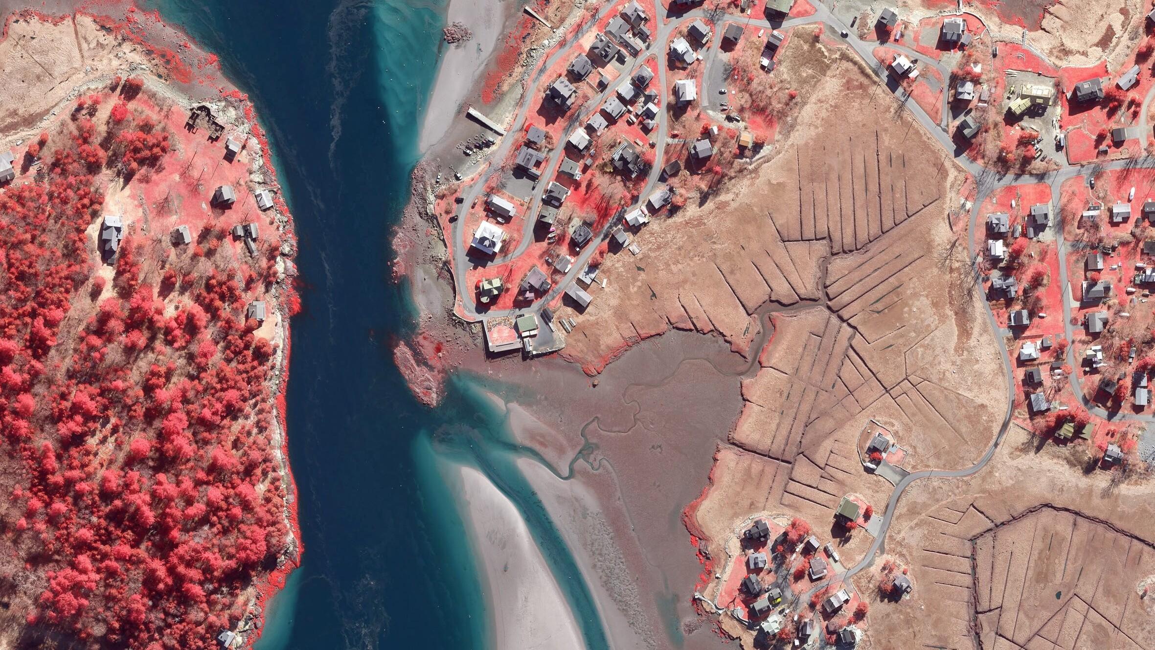
Boston University Uses Bluesky Aerial Photomaps to Research Climate Change
Researchers at Boston University are using high resolution aerial photography to investigate how important coastal ecosystems are responding to climate change. The study focused on an area of salt marsh…
Read More