


October 2024
-
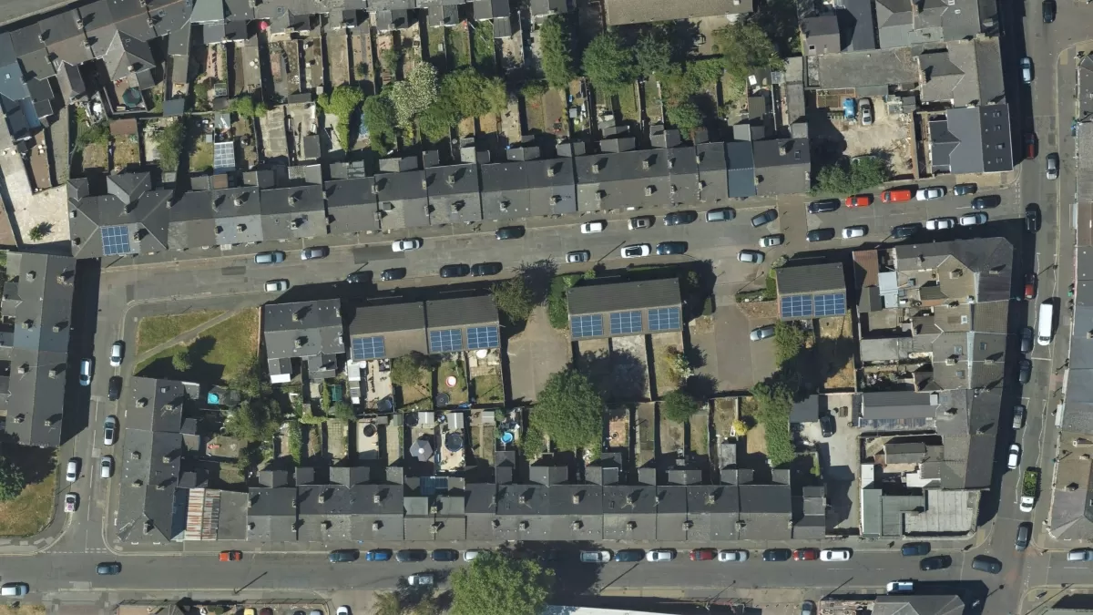
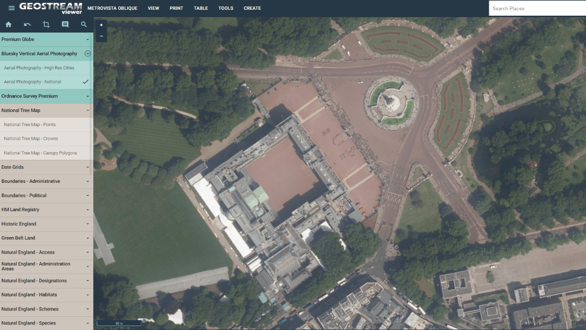
Bluesky International’s High-Resolution Aerial Photos Used to Map Ireland’s Solar Panels
Tool designed by Geospatial Insight shows Ireland’s solar set up Data will be used by local authorities, businesses and clean energy sector It’s hoped information will help fuel transition to…
Read More
October 2023
-
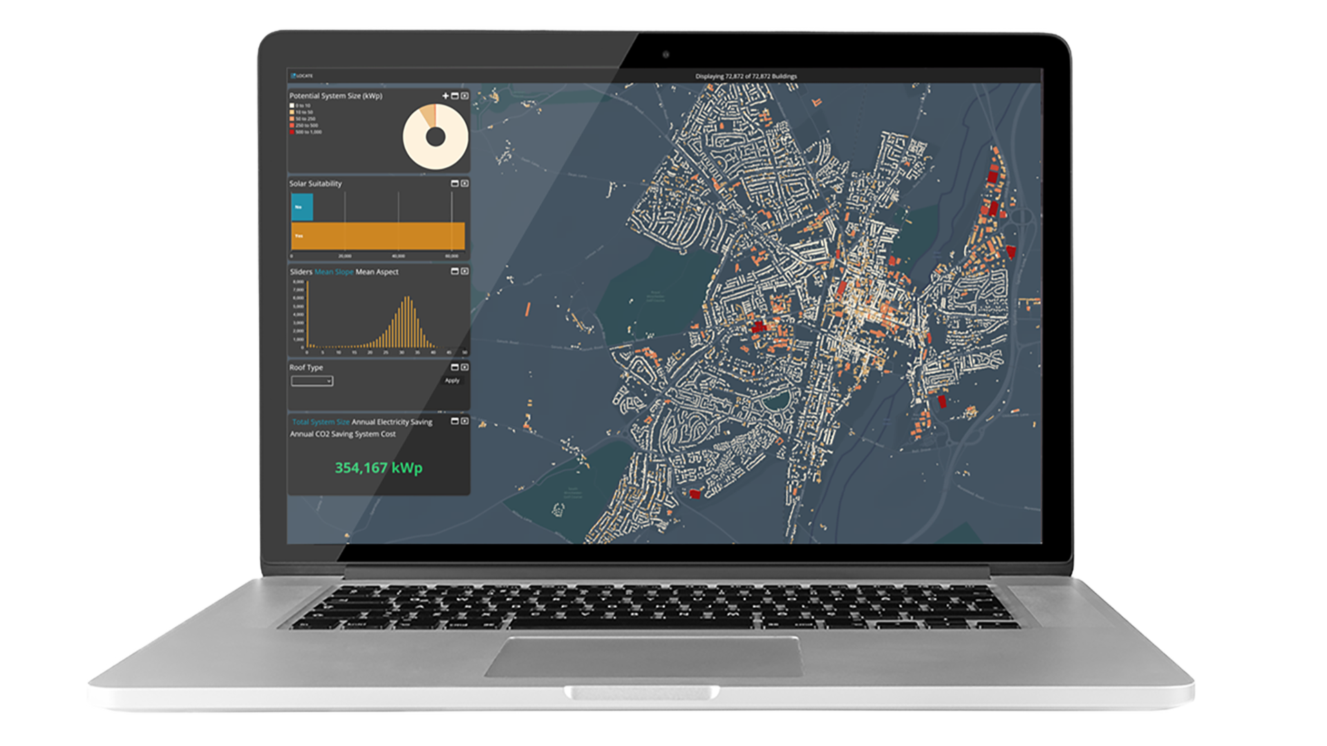
Geospatial Insight and Bluesky Launch Strategic Partnership to Drive Rooftop Solar Uptake
With solar energy becoming a crucial component in the journey towards achieving net zero, Geospatial Insight and Bluesky International are proud to unveil their strategic partnership aimed at transforming the…
Read More -
Bluesky Aerial Maps Improve Efficiency for Forest Surveys
Forest Surveys is using high-resolution imagery from Bluesky International to improve its understanding of terrain in difficult to access locations. Working with clients across the forestry sector, Forest Surveys is…
Read More
August 2023
-
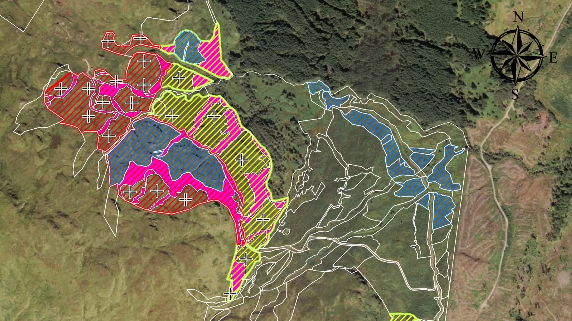
Renewable Energy Planning in Ireland
With ambitious plans to tackle climate change, Ireland has already seen a dramatic increase in energy generated from renewable resources yet there is still a growing demand that is not…
Read More
June 2023
-
Bluesky Makes a Record Breaking Start to the 2023 Mapping Flying Season
Aerial mapping company Bluesky International has made a record-breaking start to its 2023 flying season having captured more than 96 per cent of its UK flying target in the first…
Read More
April 2023
-
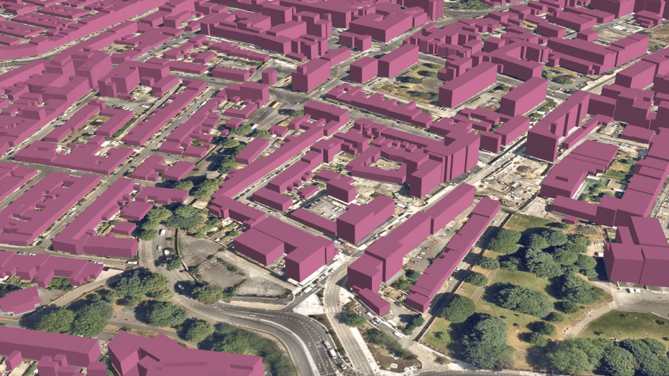
Bluesky and Ecopia Partner To Create First 3D Map of Ireland
Bluesky International and Ecopia AI (Ecopia) announce a partnership to develop the first ever 3D land cover map of Ireland. Generated using Bluesky’s 12.5 and 25 cm resolution aerial imagery and Ecopia’s AI-based…
Read More -
Bluesky Launches New Data-As-A-Service Offering
A new geospatial data subscription service has been launched by aerial survey and mapping company Bluesky designed to ensure customers can access data they need, when they need it, without…
Read More -
Bluesky Partners With Berlin-Based UP42 To Supply Aerial Imagery and Geospatial Data
Bluesky International announces a new partnership with Berlin-based UP42, a leading geospatial developer platform and marketplace. The recently signed agreement will see Bluesky supply its accurate, high resolution aerial imagery…
Read More
June 2022
-
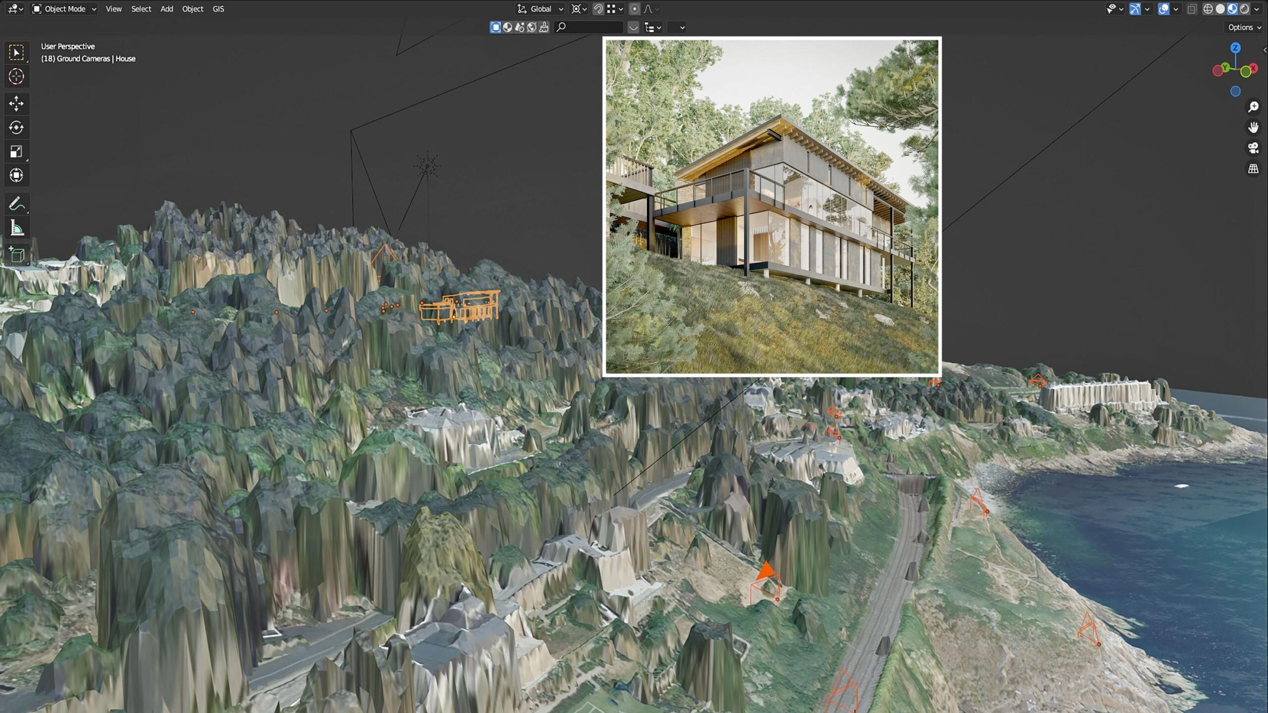
Bluesky LiDAR and Aerial Photography Bring Builds to Life for Dublin Design Studio
A Dublin based architectural consultancy is using data from aerial survey and mapping company Bluesky International to ensure the planning process is conducted as efficiently and smoothly as possible for…
Read More
March 2022
-
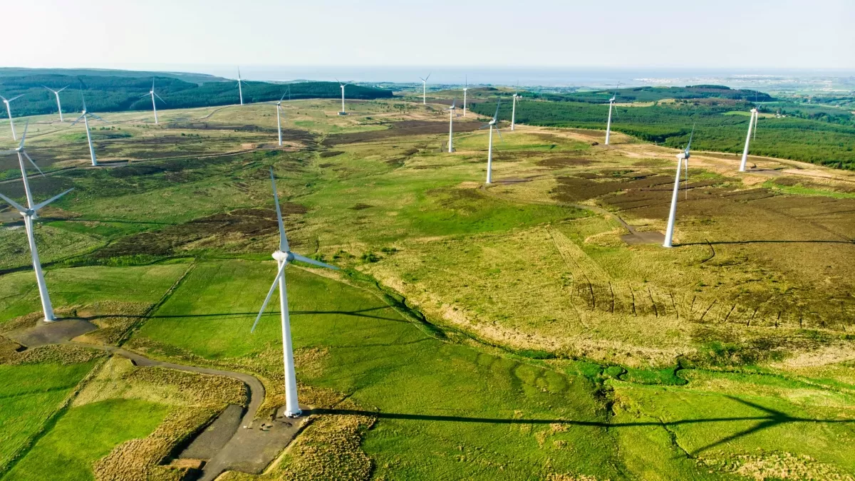
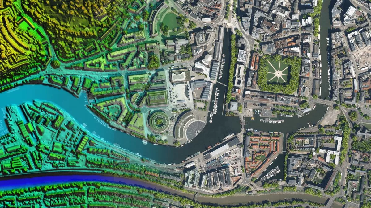
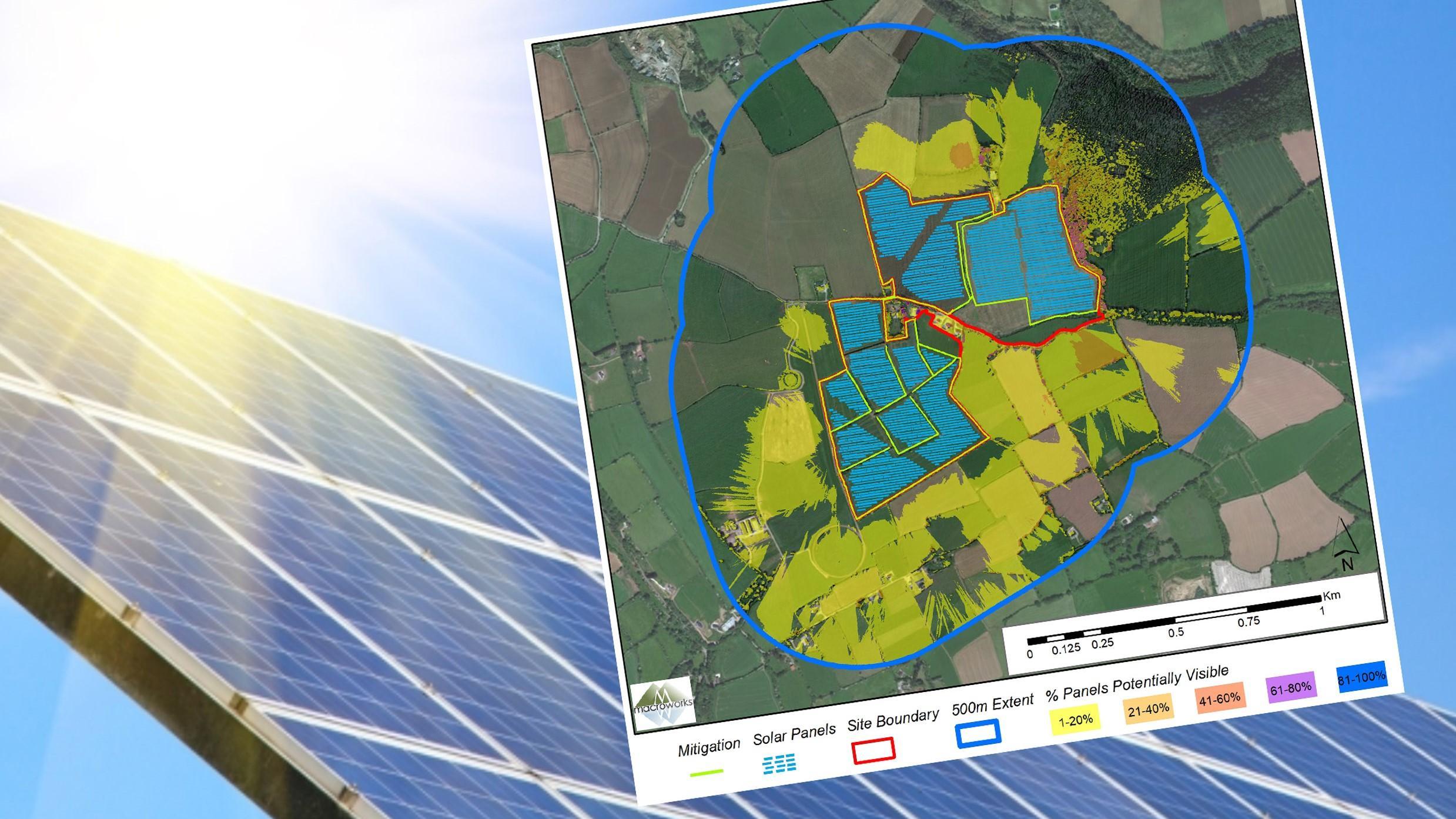
Bluesky 3D Models Help Macro Works Plan Milestone Solar Farm in Ireland
3D maps derived from the latest aerial photography are being used to secure planning permission for solar farms across the Republic of Ireland. Created by Bluesky International, the Digital Terrain…
Read More
February 2022
-
Waterford City and County Council Use Bluesky National Tree Map Data to Support Carbon Neutral Plans
Data from Bluesky International’s National Tree Map is being used by Waterford City and County Council to help benchmark current tree cover across the city and to look at suitable…
Read More
October 2021
-
Bluesky LiDAR Benchmarks Carbon Neutral Farming in Northern Ireland
A European Innovation Partnership project to accelerate the move towards net carbon zero farming is using specially commissioned LiDAR data to create a baseline for future measurements. Working with ARCZero…
Read More
February 2021
-
Bluesky Takes to the Air to Create First Ever 3D Map of Northern Ireland’s Coastline
Bluesky International will use aircraft mounted LiDAR sensors laser scanners to create a highly detailed 3D map of the whole of the Northern Ireland coastline. Working on behalf of the…
Read More